Monday, July 12, 2010

The Triple Bypass

Saturday I rode the Triple Bypass, but before I get into my ride report I want to assure everyone that Hank and Ki Branjdten's Golden Retriever, Bailey, is OK. If you have been following the Tour de France you probably saw Bailey's badly timed attempt to cross the road in front of the peloton on July 4th, during Stage One of the race. Bailey managed to take down two Tour favorites and was briefly down herself. Giro d'Italia winner Ivan Basso and David Millar of Britain were back on their bikes after the crash that occurred about 56 kilometers after the start. They were able to rejoin the main group with the help of their teammates. There must have been a tennis ball on the other side of the road or perhaps Bailey mistook Lance for Hank. When contacted by
French animal control officers, Hank told them that he was pretty sure that Bailey was down by White Bear Lake, but the screen shot from the video above clearly shows Bailey rushing out in front of the on-coming peloton. The good news is that Bailey is OK and was back home with Hank and Ki in Minnesota moments later.

I did not get a whole lot of sleep the night before the Triple Bypass. My friend Tony Klaich
came in from Chicago and spent Thursday night at my house. We got some riding in on Thursday and Friday, then Friday night Tony's fiance Ying flew in late from San Francisco. 
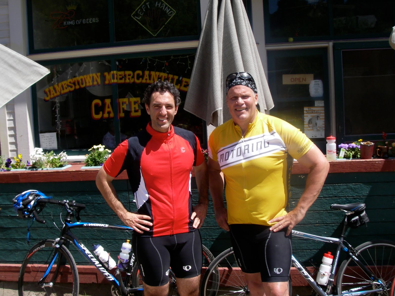
The plan was for Tony to pick up Ying and we would all meet up at a house he had rented up in Evergreen. Ying's flight was late enough that we did not get up there until about 1:00 AM Saturday morning. The good news is I found a way to absolutely crush Ironman-Distance-Triathlete Tony time-wise on the Triple Bypass course. All I had to do was get up at 5:00 AM on Saturday and start riding three hours before he did. Despite getting only four hours of sleep I felt pretty good and I was also probably helped by my inability to do the grueling ride up Left Hand Canyon with Tony the day before due to mechanical issues with my bike. All this assured me of leaving Tony pretty much in the rear view mirror for the whole Triple Bypass. I say the whole Triple Bypass, but we did not do the whole ride. We did all the climbing and most of the descending and pulled the plug on doing the final downhill into the Vail area when Tony caught up with me on top of Vail Pass.

Tony did the ride 'bandit' style, meaning he didn't actually have an entry. He thought he did, but he didn't. The race number on his helmet was one he found on the route. He had to wait to start until they had reopened Squaw Pass (the first of the three passes on the ride) to non-participants. So it was fairly late by the time Tony got to the top of Vail pass and we wanted to spend some time with Ying who had been nice enough to drive my truck to Vail to pick us up and take us back to Evergreen. With that in mind we blew off the final descent into Vail and hopped in my truck to head to the Buffalo Bar in Idaho Springs for a well earned dinner. Below is my Garmin map of the ride and the route profile.


We did 10,731 feet of climbing and 7,942 feet of descending over about 93 miles. I had a good ride and felt fine right to the end. Both Tony and I got rained on a couple of time. The weather looked like it might really get evil when I went over Loveland Pass. Below are pictures of the aid station at the Loveland Ski Area (with 3,500 riders it was a zoo), the line of riders starting up Loveland Pass, and the top of Loveland Pass as I approached the summit.


When I reached the top of Loveland Pass the wind was howling and it was starting to rain. I did not dally up there to take a photo as I have other years. I rode out of the rain on the descent and had a nice ride up and over Swan Mountain on the south side of Lake Dillon. It started raining again when I was at the aid station in Frisco and I thought we really might catch hell with rain or perhaps even a thunderstorm on Vail Pass, but we caught a break and the weather totally cleared. Below a picture of the conquering heroes.

Thanks, Tony, for coming out, and thanks to Ying, too, for coming and driving support! There is bold talk of us doing the California Death Ride in the Sierras next year which is always on the same date as the Triple Bypass. And Hank, when you read this I just want you to know that I am glad Bailey is OK and I missed you on the climbs during the Triple Bypass after all the climbing we did together in France.


Tuesday, July 6, 2010

Back in Boulder


Pictured above Andrés Salazar and myself at the beginning of a big ride last Saturday, July the 3rd, 2010. Andrés was nice enough to join me for a spin up to the Jamestown Mercantile. From there, in preparation for this year's Triple Bypass, I rode Super Jamestown, a steeper climb further up above Jamestown. Then I descended to the Left Hand Canyon turnoff and rode up Left Hand Canyon, a Boulder classic. From there I returned down Left Hand and up over Lee Hill back into Boulder. It was about 7,000 feet of climbing in 61 miles. Below are a map of the route and an elevation chart from my Garmin.

It was a great ride and I felt good afterwards. I guess France was good training for the Triple Bypass. I'll find out how true that is tomorrow. On the 4th of July I road up to Jamestown again with my friends Brenda Maller and Julie Gillaspie for the Jamestown 4th of July parade, replete with the traditional kazoo marching band, a vintage fire wagon, and all the local kids on their bikes. Brenda and Jules in Jamestown below.

Of course with Brenda leading we had to go up to Jamestown the hardway. We had the steep climb up over Olde Stage Road on the way up and we came back over Lee Hill. On the upside, up on Lee Hill Brenda spotted a Western Tanager. I love seeing these colorful birds and had not seen one yet this year.

I think a lot about how cycling in France compares to riding in Colorado. I am fortunate to live in Boulder. The riding around here is incredibly varied and great. We can ride flat on the plains or we can pretty much pick any climbing gradient we want by choosing among the various climbs west of town that take us up into the mountains. But I have also been fortunate enough to vary my riding with some incredible bicycling trips throughout the Rockies from Montana to New Mexico; in the California Sierras; in the mountains of the American South East; and of course in France.

So how does France compare to Colorado for cycling. It's different and in that difference lies the pleasure. The first time I went to France to ride was a trip two years ago when I went to the Pyrenees. A friend of mine asked me if I was sure I could make it up the Col du Tourmalet. My friend was a good cyclist and his question gave me pause. How hard could it be?
Three days before I left for France I did one of the hardest short climbs we have here in Boulder: the front side of the Lee Hill Road plus the mile and a half up the Deer Trail Road at the top of Lee Hill. The first mile of the Lee Hill Road after the Olde Stage Road turnoff averages about 11 %. There is a bit of a break and a downhill after a false summit then another three quarters of a mile of so at about 11% to the true summit to which I added another mile and a half of unrelenting steepness up Deer Trail. I road the route nonstop and thought to myself that if I can do this how much harder can the Tourmalet be? The answer was not harder, just different.

I had incredibly good riding in the Pyrenees and I thought I road well. As a Clydesdale I am not a fast climber, but the altitude difference between Colorado and the Pyrenees is huge, and while I would be gasping for air on a big Colorado climb like Independence Pass, on the Col du Tourmalet I found myself spinning easily to the top chatting with the people around me. I had pretty much the same experience riding in the Alps. The fact I ride at such a high altitude here in Colorado is a huge advantage in France (the way Hank rode in the Alps was super-impressive given that his training mostly involved spinning in front of his TV in White Bear Lake, Minnesota - elevation 950 feet). The the top of Alpe d'Huez is only 700 feet higher than my bedroom in Boulder. Compare the profile of Independence Pass.


The top of the Col du Tourmalet is at 6,964 feet. The top of Independence Pass is at 12,100 feet. The highest point that Hank and I rode to in the Alps was the summit of the Col du Galibier at 8,678 feet.

The other big difference is that the French descents were typically much more technical. You could never just let your bike go as there was always a switch back turn coming up. In Colorado I can hit 50 miles an hour on a straight away descent. That didn't happen in France. Hank told me today he wore out his rear brake pads. I put on new brake pads before I left for France. I had an inkling of what was coming.

Speaking of what is coming, as I mentioned, tomorrow is the Triple Bypass ride - three passes, 120 miles of riding and over 10,000 feet of climbing. My friend Tony Klaich has come in from Chicago to ride it with me. I'll blog about it on Sunday.

Tuesday, June 29, 2010

Day 13 - 'Le Denier Jour' The Last Day

Before I begin this post for the last day of Hank, Ki and my wonderful bike trip in the Bourg d'Oisans region of the French Alps I would like to comment on a couple of things.

First, this was my first effort at blogging and the software here a blogspot.com has been extremely glitchy. I have had a hard time just keeping the text justified within the margins and the photos properly positioned. Some of the post have changed completely with regards to word placement and I have gone back to them to find really odd breaks at the end of lines completely different from what I was shown by blogspot when I reviewed the blog before posting. I just got done completely redoing my last post and deleting the original. There have been dozens of other small headaches involved in just getting the blogspot software to work. So if you go back to any of my earlier updates and things have gone completely haywire ('Haywire' being Hank's new favorite word, he used it to bingo in Scrabble and beat me in a game at our lodge) please be apprised that it looked OK when I posted it. Also, let me know if things have gone all kaffluey so I can go back and try to fix it.

Second, I apologize for any and all errors in grammar. I could plead that I was distracted by my ongoing war with the blogspot software whilst trying to create coherent updates, but the truth of the matter is that I have grammatical blind spots and there is a reason I keep a copy of 'Garner's Modern American Usage' on my desk. Evidently ownership of 'GMAU' is not a panacea for preventing major grammatical faux pas, but it is evidence of my desire to try and get things right. So if I make any mistakes, please let me know as I want my writing to flow smoothly and not jar any potential readers with errors in usage. (My biggest grammatical blind spot so far pointed out was my more or less continuous substitution of the noun 'road' for the verb 'rode'. I attribute this to a sort of phonological dyslexia similar to the there/their/they're homophone conundrum where the distinction between the words is elemental, but the fact they are homophones deafens the editorial ear. I have gone back and tried to edit this error out of the blog and I will watch out for it in the future.)

Third, I want to thank Hank and Ki for being wonderful travel companions and the three of us want to give special thanks to Guy and Helyn at the King of the Mountains Lodge for being the best hosts imaginable.


'Le dernier jour,' our 'last day' of riding in the French Alps was especially memorable. It was unlikely that I would be able to coax Hank back into the Renault after the previous day's jeeping adventure up on the Col de la Madeleine so I quickly agreed when Hank proposed another Alpe d'Huez Ramble. One of the many wonderful things about the King of the Mountains Lodge is the incredible variety of riding in the immediate vicinity. Sure, it's all climbing, but that was why we were in the French Alps to begin with. In our two weeks at the KOM Lodge we did not come close to exhausting all the possibilities for day trips from the lodge by bike. Another great thing about the KOM Lodge is that the owners, Guy and Helyn, are avid bikers, and were always available to make suggestions or help us fine tune our ideas for rides. We pretty much new what we wanted to do for our final day of riding, but Guy gave us a great way to end it(more on that later). So at about ten o'clock in the morning we set out on our final Alpe d'Huez ramble. The plan was for Ki to meet us for lunch in Alpe d'Huez and then Hank and I would tackle two optional climbs off the main Alpe d'Huez road. We rode down the Col d'Ornan road to Bourg d'Oisans for our final assault on the classic TDF Alpe d'Huez route up the 21 switch backs on the front of the mountain. It was Saturday, and there was a huge contingent of Dutch club riders in Rabobank team kit teeming around the base of the mountain getting ready for an organized mass ride up. Supporters of this ride were waiting on all the lower switch backs. They were dressed in orange team t-shirts and busy painting their rider's
names and encouraging words on the roads. Both Hank and I got white paint on our tires. The Dutch fans were well equipped with megaphones that played the 'Olé olé olé olé' song that is ubiquitous at soccer matches and somehow seemed less annoying when one weighed it against the option of the Vuvuzela horns we were hearing every night during the Soccer World Cup back at the lodge. Hank and I started the climb on what was a gorgeous day with the expectation that we would soon be overtaken by a frenzied peloton of orange clad Dutch Équipe Rabobank wanabees, but we did not see them again until the top. For that matter I didn't see Hank again until the top as he took off like a shot, bent on improving his time up the Alpe d'Huez classic route. I don't know if it was Hank's classic Descente jersey - the envy of collectors of vintage neon cycling apparel everywhere - or a return to his doping practices of the previous week, or the fact that Hank had developed a radical new climbing strategy based on immediately getting into the easiest gear possible and spinning with a Lance-like quickness, or some combination thereof, but Hank burned to the top in record (for him) time. Well done Hank! At the top we had lunch with Ki on the front deck of a restaurant and watched as the Dutch arrive to much noise and fanfare. Air horns blasted, the 'Olé olé olé olé' song was played repeatedly, the beer flowed freely and there was much merriment on the part of the Netherlanders or the Dutch or the Orange or whatever they were choosing to call themselves that day. But the climbing had just begun for team Clydesdale.

After lunch the next stop for us was the top of the Col de Poutran and Lac Besson (Lake Besson), another 3.5 kilometers up from the Alpe d'Huez ski village.
At right a picture of Hank in his vintage Descente jersey with Alpe d'Huez below him. The road was a little rough, but the climbing is not as stiff as the climb up the classic route we had just made. From Lac Besson we descended back to Alpe d'Huez and began the climb up the rough, but rideable, road to the top of the Col de Sarenne. To give you an idea of where we went I have once again cribbed the excellent map from the www.cycling-challenge.com blogspot, which is an outstanding source of information on riding in the French Alps. The KOM lodge is in Rivier d'Ornan on the bottom left of the map below. Route D526 is the road over the Col d'Ornan. The black squiggle is the main route up Alpe d'Huez. The red line is the route up to Lac Besson. And the green line is the route up and over the Col de Sarenne. The Col de Sarenne
road was even rougher than the Col de Poutran route up to the lake, but it, too, was rideable. There were plenty of warning signs attesting to the roughness of the road. This one reads
'Summit in 3 miles / Roadway in a Bad State', and they weren't kidding. I had not seen this many warning signs signs since Dorothy's approach on the Emerald City of Oz. Hank, as usual, could not resist the opportunity to play the clown. It was not at bad as all that and we agreed it was a
great ride with an marvelous descent from the top of the col. We saw no other cyclists on this route was incredible considering the throng of Dutch riders on the front side. Here are some pics of the descent. From the top it was like looking down into an abyss.
At the bottom we came out on the main highway in the valley, route D1029. Rather than follow it directly into Bourg d'Oisans we took the advice that Guy had given us in the morning and went up the Les Duex Alpes ski area road, with an eye towards riding up to a high shelf road on the south side of the valley that would take us through the hamlet of Les Traverse. From there we would have a long forested descent down to the main road and back into Bourg d'Oisans. All through our trip Guy and Helyn from the KOM Lodge were giving us great ideas to add something to our rides (any and all of the cycling miscues previously chronicled in this guide - the wrong ways up cols, the jeep trip, were purely my doing).

The ride up towards Les Duex Alpes was great, a somewhat gentler grade than the Alpe d'Huez road, and, of course, Hank got summit fever so nothing would do other than riding past the Les Traverse road up to the Le Deux Alpes ski station on top and then back down to the shelf road for the ride home.

In Bourg d'Oisans we stopped so I could get a coke to fuel my last ascent up the Col d'Ornan, then Hank and I did our last climb up to the KOM Lodge. It had been a great day with a metric century of riding (100 kilometers) as Hank pointed out and about 9,150 vertical feet of
climbing. And it had been a great trip. Team Clydesdale had triumphed over the high cols of the French Alps! That night Hank and I disassembled and boxed our bikes for the trip home early the next morning and agreed that we would try to come back next year.

Day 12 Col de la Madeleine Via the Col Du Chaussey


Today we decided to check out the well known Col de la Madeleine and the little known Col du Chaussey. The Col de la Madeleine is one of the major routes running north to south over the Alps and their is a major ski station at the top. This year's Tour de France will cross the Col de la Madeleine on July 13th during Stage 9 of the Tour. For the TDF the Col de Madeleine will be the last of four cols on a 204.5 kilometer day, a huge day of climbing that will no doubt be a determining factor in the race for the yellow jersey.
On the day the TDF goes over the Col de La Madeleine Hank and I will be able to put our feet up in front of the TV as Hank is demonstrating above and say with full confidence, "Yes, the Col de la Madeleine. That's a tough one. I remember it well."


But we decided (well, I decided - not we - what follows here is all my fault) that it might be interesting to ride the Col du Chaussey as an alternate approach to the top of the Col de la Madeleine from the south side. The Col de la Chaussey is the same col I mentioned in day one of this blog - the one with the 'lacets' or 'shoelaces,' tighly winding switch backs that looked to be spectacular. What could possibly go wrong with this plan? It seemed that we would run into about two kilometers of rough road at the top of the Col du Chaussey, but if it was unrideable we would be able to put the bikes in the back of our Renault Kangoo and drive them. So we drove over the Col du Glandon to the foot of the Col du Chaussey and started our climb of the Col de Madeleine and started our climb from there. It was a beautiful climb through forests and along cliff roads. I kept expecting the 'lacets' to begin but they never did. After 3,400 feet of climbing we popped out at the summit of the Col du Chaussey.

We had, evidently, once again fallen victim to the alternate approach from the bottom of the col syndrome. The' lacets' were well below us now, on some side road that fed into the route we had come up from Pontamafrey.We should have started in Montvernier, a bit to the west on the main road, but we had seen the signs for the Col du Chaussey and thought that we were there. Oh, well. We had done the climb but without the novelty of riding the Lombard Street of San Francisco-like 'lacets.'
I blame myself and I'm sure Hank and Ki do, too. Then, of course, things got worse. we had to drive the 2 kilometers of dirt at the top, but then we found pavement and Hank and I started to climb towards the top of the Col de la Madeleine by bike again. 1.87 miles and 860 vertical feet of climbing later the road became unrideable again and we forced to begin an activity that would best be described as 'jeeping.' The road was extremely rough, suitable for mountain bikes, but not road bikes. It took us high up onto the ski hill above the main highway on the Col de Madeleine. Then eventually we dropped down to the main road near the top of the col. We had a late lunch on the deck of a scenic restaurant at the summit of the col. Then Hank and I hopped on our bikes and dropped down the north side. We were running out of time so we only went down 9 kilometers to where they were doing some road work on the main route in the middle of the first small town on that side. Hank and I climbed the 2,200 feet back up to the summit. We were finally once again on the route, 'la bonne route,' of this year's TDF. On top Hank put his bike in the car - some of his spokes were loose and he did not want to chance the descent - and I road the first part of the descent. It was a beautiful day. We got in about 6,500 feet of climbing in about 25 miles of riding, but we had lost a lot of time with our jeeping adventure and in justdriving over to where we started our ride, so we had to hop in the Renault and head back home to our lodge.


Thursday, June 24, 2010

Day 11 Even the Mellow Days Are Hard Here!


We did not get our drained of gasoline and properly fueled with diesel Renault Kangoo back until 11:30 this morning and with that in mind we elected to ride close to our lodge. The choices for riding around here are endless. There are a million options. Bourg d'Oisans lays just to the north of the Parc National des Ecrins and the area is a Mecca for 'rando' (hiking, short for 'la randonée') as well as cycling. Even the Bourg d'Oisans valley which lies out of the actual National Park des Ecrins has a Yosemite like feel with incredible cliffs and waterfalls everywhere you look.

So we decided to have lunch at our favorite pizzeria in Bourg d'Oisans then ride 20 miles up the Venoen Valley through Saint Christophe to Bérarde where the road comes to an end. This was a beautiful climb up a back country valley in the heart of the Ecrins Park. An incredibly wild river runs down the valley and here again there are many Yosemite like cascades of water coming off of high cliffs.

We thought it would be a pretty mellow day, but there are some steep climbs with switch backs in the park. It was a much stiffer ride than we had anticipated, but it was just beautiful. We are constantly being surprised by the options for riding we are finding here (although pretty much everything involves climbing) and we are already talking about when we might be able to come back. All and all we had about about 3,800 feet of climbing in the park and about 50 miles of riding going here and there. We did some shopping in Bourg d'Oisans on the way back to the lodge and skipped the ride up the Col d'Ornan electing to sag back up the hill in the Renault. We have a big day planned for tomorrow! We have two days of riding left as our tine here is sadly coming to an end. It has been a great trip!


Wednesday, June 23, 2010

Day 10 Encore de Contretemps!

We started the day with a solid plan. We were going to drive from our lodge to the old fortified town of Briançon for lunch and a walk about then drive round to the town of Guillestre on the south side of the Col d'Izoard and ride over the col back into Briançon. From there we would drive home having notched yet another famed col of the Tour de France.

The whole plan fell apart before we even got out of Bourg d'Oisans. We had to gas up our Renault Kangoo so we stopped at a service station and I dutifully figured out which of the nozzles on the pump was unleaded gas. Then I pumped in 34 liters of 'esssence sans plomb' before I noticed the tiny sign on the back of the Renault's 'gas' cap cover that said 'diesel' (gazole in French.) The Renault was so small and ran so quietly it never occurred to me it had a diesel engine. The day was seemingly shot. At least we hadn't started the car and driven it away or filled up 50 miles away from Bourg d'Oisans where we had picked up the car. We called the garage where we had rented the Renault and had them come tow it so they could drain the tank. Then we walked into town for lunch.

But wait! All was not lost. We were at the foot of Alpe d'Huez, had our bicycles and it was early in the afternoon! So after arranging for Ki to get picked up in town we prepared for another ride up Alpe d'Huez. Then Hank figured out he had left his cycling shoes back at the lodge. Even more bad news for Team Clydesdale as Hank was unable to ride from town without his shoes (and he would have been totally out of luck if we had in fact made it to the start of our ride up the Col d'Izoard.) So it was decided that I would ride Alpe d'Huez on my own and Hank would go back to the lodge and do a ride on the back side of the Col d'Ornan.

I started up the famed ride sans
Hank for the first time. It was clear his fans missed him as his name was still painted on the road. It was a beautiful day for the climb. Even a bad day of riding in France is somehow a good day. If anyone ever asks me if I ever have been up Alpe d'Huez I can answer, 'Why yes, many times.' At this point I know the climb fairly well. I went all the way past the top to check out the approach to Lac Besson which lies another 3.5 kilometers and 200 verticle feet above the ski resort at the top of the famous climb.

After satisfying my curiosity I dropped back down into Bourg d'Oisans and did the ride back up the Col d'Ornan to our lodge. My total mileage for the day was 31.5 with 5,752 feet of climbing. Hank had a great ride off the back of the Col d'Ornan, too. Below is a picture from lower down on the climb of the towns of Huez and higher up Alpe d'Huez just below the clouds on the ridge line. And below that a picture of the marker at the finish line for the TDF route up Alpe d'Huez.

Tuesday, June 22, 2010

Day 9 -The Col de Parquetout and the Col du Noyer


Today Team Clydesdale decided it was time to start trying to ride some of the cols that this year's Tour de France will ride this July. Our goal for the day was to ride the Col du Noyer which will be featured on the 10th Stage of this year's TDF on 14th of July. The tour riders will cover 179 kilometers between Chambéry and Gap. It is a medium climbing day with the biggest climb being the Col du Noyer. The word 'noyer' is French for 'walnut tree' and we decided to crack the nut (la noix) before the tour does (the word 'noyer' is also the French verb for to drown and, yes, we were hoping not to drown in our attempt to ride the col.)

But first we had to get to the area of the Col du Noyer which is a fair distance to the south east from our lodge. We decided to ride part way there and knock off the little known, but extremely steep Col de Parquetout enroute. Then we would have Ki meet us with the Renault and we would drive to the town of Corps for lunch. From Corps we would drive to the town of La Motte and begin the approach to the Col du Noyer.

The Col de Parquetout begins just past the town of Entraigues at the bottom of the south side of the Col d'Ornan, so we rode the three kilometers from our lodge on the north side of the col and descended to the bottom of the Parquetout. The Parquetout is only a seven kilometer
climb, but the average grade is well over ten percent. The TDF will not be going over it any time soon as it is an extremely narrow one lane road that winds up through the forrest. It is the site of a local bicycle hill climb event whose organizers have thoughtfully painted the percent of the road grade every 100 yards or so on the pavement so you can look down and read 16% or 12.5%. It is one of the few climbs I have been on where I have been happy to see that a stretch of the grade was rated at 10% as that seemed like a bit of a break after a lengthy 16% grade.

Ki passed us in the Renault near the top and eventually Team Clydesdale triumphed and made our way to the top. Hank hopped into the car with Ki and I rode down the backside of the col to the first town where I joined them for a quick ride to Corps and lunch.

After lunch we drove to La Motte and began a beautiful ride that had been recommended to us by Helyn, one of the owners of the King of the Mountain lodge, that served as our approach on to the Col du Noyer. We had a gentle climb through a curving valley with a wild river below us and some beautiful
cliffs above us that eventually took us to a point that joined the 2010 TDF 10th Stage route and the climb up the Col du Noyer.

This is where the trouble started for Team Clydesdale. Nothing comes easily for us when it comes to climbing. Just past the junction of the beautiful backwater country road we had just ridden and the main route, the main route was closed for bridge repair, probably in preparation for the upcoming TDF stage. Ki had to turn back with the Renault and drive a circuitous route to find the other side of the Col du Noyer. The plan was she would meet us at the top. Hank and I began the 17 kilometer climb by bike up the col. Things went swimmingly for a while. We didn't drown and it was a mellow climb. Then we came into the town of Saint Etienne and things went south in a hurry. There was an enormous horse loose on the bridge coming into town. Then, in the town, we ran into yet more road work being done. Rather than take the detour we rode through the construction zone and almost immediately came upon a sign for the Col du Noyer that pointed up an extremely narrow, extremely steep street. Up we went through the steeply curving back streets of Saint Etienne wondering if this could possibly be the right road. It seemed unlikely that the TDF was coming up this way.
We came upon a woman at the top of her driveway and I asked her if this was 'la bonne route' (the right way) up the Col du Noyer. She assured us it was and asked us if we had seen 'un cheval' (a horse.) We had, in fact, just seen a fellow clydesdalesque animal and in my broken French I told her where it was. It seems it was her son's horse and it had run off. Back on our bikes we continued to climb up a paved road that was as steep as the Parquetout climb of the morning in places, but with the occasional pothole and a fair bit of sandy gravel. We immediately saw a large sign indicating that this was the way to the Col du Noyer, but clearly the TDF was not coming up this cowpath. We had stumbled onto a back way up the col. 2.5 kilometers from the top of the col we popped out onto the main route - la bonne route - and from there it was an easy spin to the top.
We had cut 3 miles or so off the route so if Lance is behind at that stage of the TDF we can show him a short cut. We had about 7,600 feet of climbing in two rides that totaled about 36 miles. Below is a picture of Hank being melodramatic about the difficulty of the day.


Monday, June 21, 2010

Day 8 Alpe d'Huez Ramble


Day 8, Monday the 21st of June and it was cold this morning with fresh snow from yesterday still visible from the lodge. So we elected to do a series of climbs in, on and around Alpe d'Huez, the thought being we would stay reasonably low and close to the King of the Mountain Lodge, while we got in some fantastic cycling on some of the shelf roads that link up with the famous 21 switch back route that goes directly up from Bourg d'Oisans up to the ski resort on top of Alpe d'Huez. At right is a view of Bourg d'Oisans from the shelf road that approaches Alpe d'Huez from the north west. It is quite a steep drop off and the one lane road leads to interesting passing situations when two cars meet going in opposite directions. Cars honk as they go around blind corners. Hank and I had already ridden this route on day 3, but we liked the climb so much we decided to do it again. The road is much quieter than the main route up Alpe d'Huez. Below I attach the map my Garmin GPS generated of today's festivities.

We started our ride from the bottom left of the Garmin map with a descent from our lodge on the Col d'Ornan and drop the 8 kilometers down to the valley highway. There we took a left hand turn and headed north up the valley where we took a right hand turn and started up what is the beginning of the climb to the col de la Croix de Fer. The hard right we make at the the top of the map is the beginning of the switch bacyks up to Villard Reculas. Even though we avoided
the switch backs on the main Alpe d'Huez route we still had to gain all that elevation to get that high up on the mountain. The stunning views from the shelf road make it worth the climb. In the picture left you can see the bottom of the road up the Col d'Ornan just left of my left elbow. It's hard to believe Hank and I came down that road earlier the same morning. It's the same road we would go back up at the end of our day.
Where our route runs into the great squiggly mess of GPS points on the Garmin map is where Hank and I hit the main route up Alpe d'Huez. The picture below left is of Hank on the shelf road with some of the middle switch backs on the main Alpe d'Huez route below him.
We saw three other riders on the shelf road, one ascending and two descending. There were dozens of cyclist going up and down the main Alpe d'Huez route. We took a hard left onto the main road and headed up to the top, through the town of Huez and finally to the ski resort on the summit. Then we dropped all the way down into Bourg d'Oisans going through all 21 switchbacks to meet Ki for lunch - a well earned pizza for each of us.
After lunch we said good bye to Ki and started back up Alpe d'Huez on the main route. We rode up the first six switchbacks to the tiny village of La Grade where we took a right off of the main Alpe d'Huez route and headed south east on another climbing shelf road, somewhat lower down on the mountainside than the first shelf road. The second bump on the elevation chart from my Garmin GPS shown here shows the altitude gain on our second climb of the day.
We again had beautiful views of the Bourg d'Oisans valley 2,000 some feet below us from a narrow one lane road perched on the side of the mountain.
Hank tried to kill me on this road.
He told me to spin back down it a little ways and come back up so he could take my picture. As I started down I heard a rattling sound above me and then a piece of shale the size of a college textbook crashed on to the road. I expected that this might be the start of a stony deluge, a rock slide of Las Vegas slot machine jackpot pay out like proportions, but that was it. Nice try, Hank, but no cigar. The resulting photo is here to the right. In the photo you can see Bourg d'Oisans in the valley below. We took the shelf road a considerable distance to the south where it finally came to a summit and started to drop back down into the main valley. It was mostly downhill all the way back to Bourg d'Oisans. From there we made the climb back up the Col d'Ornan to our lodge. The total climbing for our day was 8,239 feet in 56 miles of riding. It was another great day of riding for Team Clydesdale.

Day 7 Snow

Day 7, Sunday, June 20th, the day before the summer solstice, and we awoke to snow on the hillside above the King of the Mountains Lodge. There was no snow on the ground at the lodge, we were below the freeze line, but it was clear that there would be snow and rough weather near the top of all the major climbs. So we took the day off and drove the Renault into Bourg d'Oisans for a leisurely lunch.

The forecast was and is for steadily improving weather and we have another six days to ride, so a rest day was not a bad thing. A group of four very good riders from Wales that were also staying at the lodge tried to ride the Col de la Croix de Fer. It was their last full day to ride and they were understandably keen to make the most of it. The four of them made it to within three kilometers of the top of the col before they were beaten back by freezing sleet. They really suffered on their descent and took shelter in the same bistro in Rivier d'Allemond where we had had lunch on our two Col de la Croix de Fer. The Welshmen were quite happy to get back to the lodge.

Tomorrow is another day and we have big plans!

Saturday, June 19, 2010

Day 6 - Col du Galibier via the Col du Telegraphe


Today the weather looked like it might get sketchy with the possibility of rain, so we decided to use our rental Renault Kangoo (I have been mistakenly calling our Renault a Kangaroo, the model is actually called a Kangoo & the French word for Kangaroo is Kangourou. My bad.) to drive over the Col de la Croix de Fer to St-Michelle-de-Maurienne and start our ride from there. The plan was to ride the Col du Galibier via the Col du Telegraphe, the thought being that even if it did start to rain we would be warm while we were climbing the two cols and that if the weather was really bad when we reached the top of the Col du Galibier at 2,674 meters (8,678 feet) we could beat a hasty retreat by car. It is no big deal climbing in the cold as the exertion of climbing keeps one warm, but descending in the cold is an extremely different proposition as your body is no longer producing that much heat and a speedy descent creates quite the wind-chill factor. Factor in the wetness factor and things can get miserably cold.

It was pouring rain as we drove over the Col de la Croix de Fer, but that did not seem to be stopping dozens of hardy souls from starting a Saturday ride up the col. We drove out of the rain on the far side of the col and into La Maurienne Valley. Once again, it looked like Team
Clydesdale had caught a break as the weather looked good for our climb. I even put on sun screen. Both of today's col featured kilometer markers like the one pictured to the right that tell you just how far you are from the top of the respective col and what the average road grade is for the next kilometer of climbing. The Col du Telegraphe was a fabulous climb with fantastic views of the valley below and the switch backs of the road we had just come up. After we summited we dropped down into the town of Valloire in the saddle between the two cols and had lunch. As we started up the Col du Galibier it began to rain lightly, and we would have percipitation all the way to the top. As we climbed the temperature dropped, and we knew it would get colder as the weather forecast for tomorrow was calling for snow and today had been chillier than yesterday from the get go. So that, coupled with the fact that the Col du Galibier is about 600 meters higher than the Col de la Croix de Fer suggested that we might get snowed on. About five kilometer from the top we road into the white. At first it was just a combination
of fog and mist, but with about three kilometers to go it turned into a foggy white light snowfall. We saw riders coming down and they looked like they were suffering. One English speaking rider declared he could not feel his hands. Team Clydesdale opted for a mountain top finish and at the top of the Col du Galibier we loaded the bikes into the car and headed down the other side and back to our lodge. We were done after just under 22 miles of riding and 6,963 feet of climbing. Pictured at left Hank disappearing into the gloom toward the summit. The view from the summit itself was very much like what I imagine the view of the inside of a Clorox bottle would be if it was illuminated. It was rather like being in a very big, very cold, very wet, white room. But we got our ride in, so I count the day as a triumph.