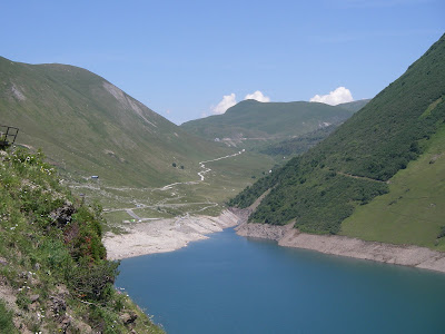
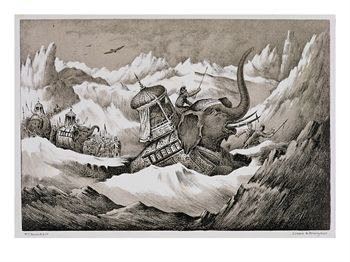
Just over a year ago, on June 19th, 2010, Hank Brandjten and I rode the Col du Galibier from the north side. We had Hank's wife Ki drop us at the bottom of the Col du Telegraphe and she went up with us as a support car. We had a lovely lunch in Valloire in the saddle at the top of le Col du Telegraphe, then Hank and I started up le Col du Galibier where things started to get cold and white. Climbing up in a snow storm is no problem, but descending in a snow storm is not much fun.
So Hank and I were cheated out of our descent down the south side of the Col du Galibier. We wisely loaded the bikes into our car on top and Ki drove us home to the King of the Mountains Lodge down the south side of the Col du Galibier and then down from the Col du Lauteret.
Yesterday was a beautiful day here in the French Alps and there was no chance of any snow on top of the Galibier, so I decided to ride from the KOM Lodge to the top of the Col du Galibier from the south side. It was my eighth day in France and my eighth day in a row of hard riding. The route started out the same way as my last two days of riding did with a descent from the KOM Lodge down to Bourg d'Oisans and a ride up the Romanche River Valley.

After the first bit of climbing along the river I came to the first of many tunnels on the route up through La Grave to the Col du Lautaret. I had passed through the same tunnel twice already on the last two days of riding and I was getting used to it. The signage with the bike with a red slash through it in the photo would make one think that no bicycles are allowed in the tunnel, but actually it means that the bicycle lane is ending. There is another sign just beyond it telling motorist to keep a meter and a half between themselves and cyclist when the motorist have an opportunity to pass - even in the tunnels. The safe passing signs are fairly common and by and large the drivers are much better at sharing the road with bicyclist than American drivers are.
Legally you need a tail light on your bicycle in the tunnels. I have both a small head light and a tail light on my bike. Alberto Contador and his team got stopped by the Gendarmes within the last week or so for not having tail lights when they were previewing the Tour de France course. Contador's team tried to argue that the headlights from their support cars were enough, but the gendarmes made them load their bicycles on their cars to pass through the many tunnels. Two of the tunnels are 700 meters long. I have no idea what the gendarmerie would have done had it been a French team without tail lights for their bikes.
As always there were some beautiful views along the way.
Soon I had passed the spots where I had turned off the road on the last few days. This route over the Col du Lauteret is the main route between Grenoble and Briançon, through Bourg d'Oisnans and Le Grave, and I was making the fairly gentle ascent along the river up to Le Grave.
There were several flashing signs letting drivers know that the two cols were 'OUVERT' - meaning 'OPEN.' The Colorado Department of Transportation, CDOT, would do well to copy this system for Independence Pass.
This sign's flashing message about the pass being open alternated with an admonition to drivers and bicyclist to 'PARTEGEONS' - 'SHARE' the road
I had lunch in Le Grave. The view below was from the patio of the restaurant on the main road in the middle of town.
Here is the view back on Le Grave from further up the pass.
Another neon sign above Le Grave saying both passes are open.
And the road keeps climbing. Notice how the terrain is getting more Alpine.
 |
| Looking back down the pass |
Finally, after 30 miles of climbing I came to the top of the Col du Lauteret.
The last time I was here it was snowing. Yesterday it was beautiful. I didn't even need my jacket for the descent. From here if you go straight on the main road you drop down into Briançon. But a left turn off of the top of the col takes you up le Col de Galibier.
 |
Notice all the motorcycles coming off of the Galibier.
|
It's another five and a half miles of climbing to the top of the Galibier.
 |
| The view back down to the buildings on top of theCol du Lauraret |
One of the big last switchbacks reminded me of the big bend at the top of Independence Pass, but there was still lots of climbing to be done.
 |
| The big bend on the Galibier |
Still climbing. It's hard to see, but the little dip in the ridge line in the bellow photo is the top. There are several switchbacks below it.
And finally I made it.
They say that the camera puts on five pounds. As Hank says there must have been a lot of cameras up there.
On the descent I stopped for half of a sandwich at the top of the col du Lauteret. A big herd of sheep had come down to the col.
It was 72 miles round trip from the KOM Lodge to the top of the Galibier with 8,200 feet of climbing. I had a bit of an adventure on the way back that I will try to blog about latter. No big deal, though, really. It was a fun ride! Ciao.


