Wednesday, June 22, 2011

What would Hank do?

Today was my fourth day in France and when I woke up it was raining.  The forecast was for rain all day long so I thought I might get a break from cycling, and, by extension, a one day break from blogging about cycling.

Like last year I thought I would be able to do a simple post with a rain cloud and the comment -'Il pleut' - It's raining-.  Something like this:

"Il pleut' - It's Raining - No riding today.

So I went back to bed to read and snooze with the happy thought that I was going to have a guilt free day off.  But early in the afternoon the clouds broke up and the sun came out and I was left with the question what would Hank do?

I knew the answer because I was chatting with Hank via facebook texting yesterday and he asked me a if I had done the Col de Parquetout again yet.  This was the stiffest climb we had gone up last year and it is relatively close to the lodge.  It is a relatively short, but it is brutally steep.  Here is the profile:


The Col de Parquetout is off of the back side Col d'Ornan, the col the King of the Mountains Lodge, my little pension here in the Alps, is located on.  To get to it you have to go over the top of the Col d'Ornan, about a two mile climb, then you drop down the other side to the town of Entraigues.  The col is just past Entraigues on the right side, a stiff climb out of the valley.  Here is another profile of it:


You get the idea, about seven kilometers of ridiculously steep climbing, but the climb is beautiful, up through a forest, on a sun dappled single paved lane.  I saw one car the whole way up and no other cyclists.  The local bicycle racers have thoughtfully painted the road grade on the pavement every hundred yards or so, just in case you are wondering how steep the route is.
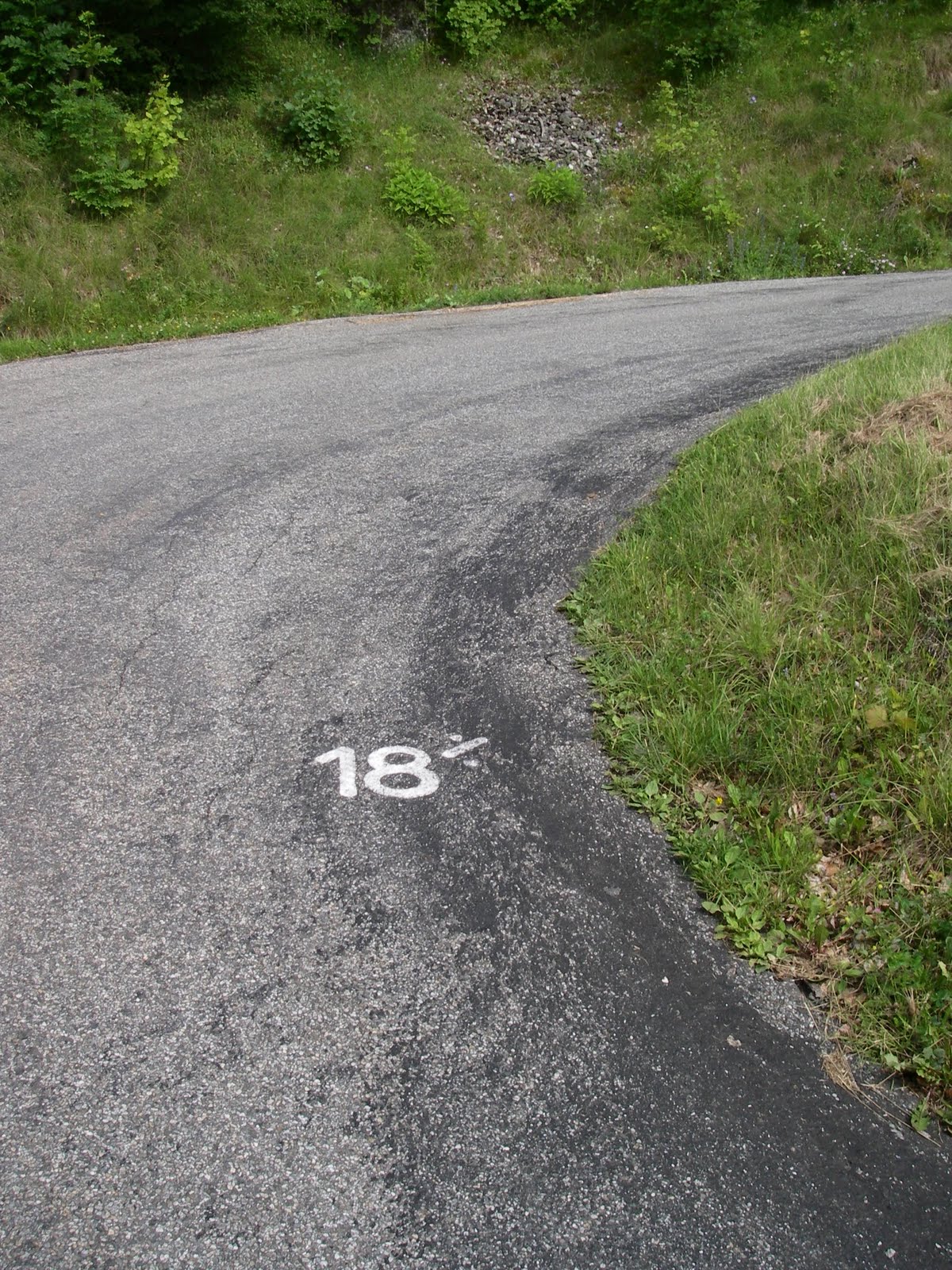

So how steep was it?  For my friends in Boulder lets just say it is easily as steep as Super Flagstaff where it gets crazy above the amphitheater.  I was mostly standing on the pedals through the middle of the climb.  The biggest difference is the elevation.  The summit of the col is as 1,382 meters or 4,534 feet, so what I notice is how much easier it is to breath.  There is a lot more oxygen than I am used to when I climb at home.  I never feel like I am going to blow up and have to stop to recover, like I have to do sometimes on Super Flagstaff.  I had a wonderful climb.  It was cool in the tree, lots of shade, and the road surface was great.  In some place it actually had a thin layer or moss or lichen growing in its aggregate base:


Coming back though Entraigues I checked out the WW I memorial near the center of the village.


This is a tiny village, one cafe that was closed, no supermarket or convenience store or gas station, and there were 32 names listed, sixteen on each side of this monument, representing their war dead for the First World War.  An entire generation wiped-out.  On the back of the monument were the names of three men lost in the Second World War, and one man lost in Algeria in 1957.

Everywhere I ride in France I see monuments to their war dead.  Also today, at the top of the Col d'Ornan, there was this:


And on a bridge near the village of Entraigues this:


There was a lot of fighting in these mountains during the Second World War and the German reprisals against the Resistance were so brutal there is still much ill-will towards them.  The biggest insult you could make was to call somebody a Collaborator.

From the bottom of the Col du Partquetout it was about a 17 kilometer climb back to the top of the Col d'Ornan.


The summit was a welcome sight.  What had started out as a rain day had become a 35 mile late afternoon ride with about 5,000 feet of climbing.  If Hank was with me I am pretty sure this is what he would have wanted to do today.


Tuesday, June 21, 2011

Le Col du Glandon / le Col de la Croix de fer

Today was day three is the Alps and day three on the bike.  Today I decided to try and tackle le Col de la Croix de Fer again.  The day started almost as it always does with a five mile descent from the King of the Mountains Lodge down the Col d'Ornan into the Romanche Valley, the valley that Bourg d'Oisans lies in, but instead of turning right and riding into Bourg d'Oisans I turned left and headed for the climb up le Col de la Croix de Fer.


It is a long climb that I did a couple of time last year with Hank.  Le Col du Glandon is a side road a couple of kilometers from the top and you come to its summit within a 100 meters of the road up le Col de la Croix de Fer so you basically summit two cols for the price of one.  The climb gets steep in a dense hardwood forest about 24 kilometers from the summit.  The road then becomes a bit of a shelf road above a valley until you pop out in the village of Le Rivier d'Alemont.  I stopped there in the same cafe where Hank and I experienced a rain-out of the same climb last year, but today the weather was beautiful. 


I have been trying to drink less Coca Cola as of late, but during rides like this I don't particularly worry about it - I need the fuel.  So I had a couple of Cokes, only 1.5 Euros here, cheap by local standards. and a blueberry tart and continued the climb.  There is a huge drop right after le Rivier d'Alemont followed by an extremely steep up-hill section that mellows a bit after a few kilometers.  On the way back down the Col you have to climb out of the same hole.

The terrain becomes alpine (meaning no more trees) and you start to see large flocks or sheep occasionally being worked by their shepherds who use Border Collie-like dogs to work them in the steep terrain.  It is incredible to see how fast these dogs can move up hill.  You go up some switchbacks and pass a reservoir and soon you can see the bistro at the bottom of the turn-off for the Col du Glandon and,  two kilometers beyond that the summit of le Col de la Croix de Fer.


I rode past the bistro, le Chalet du Grandon and continued the 100 meters up to the summit of le Col du Grandon.  On a clear day they say you can see Mont Blanc from there.  It was not a clear day, in fact, it looked like it night rain.  I dropped down to the bistro and had yet another Coke and a sandwich.  Then the sun came out and suckered me into riding up to the summit of le Col de la Croix de Fer.  I say it suckered me because as soon as I got on top it started to drizzle.  But it was not that bad.  I headed back down the way I had come up and road out of the drizzle around the reservoir.  At the bottom I was back in the Romanche Valley and I made the right hand turn back towards Bourg d'Oisans.  The five mile downhill on the Col d'Ornan I had enjoyed as I do pretty much every day I leave the King of the Mountains Lodge was now yet another five miles of uphill.  But I felt good.  It was a sixty mile day with about 7,300 feet of climbing.  Here is the my Garmin route map for the day.

Le Croix de Fer

Monday, June 20, 2011

The other side of the valley. Day 2 in France.


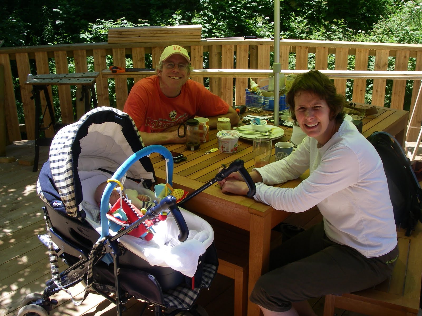
Before I write anything about today's festivities I would like to introduce you to my hosts here at the King of the Mountains Lodge.  Pictured below are Guy and Helyn, the owners of the lodge and the newest member of their staff, Alice, born this Spring


I woke up this morning and had a big breakfast.  It was a beautiful day and I was thinking about riding something heroic, but I realized I was thoroughly wiped-out from jet lag.  I want to stress that my being tired had nothing to do with me having tackled Alpe d'Huez on about four hours of sleep the day before.


So I went back to bed and slept until about one o'clock.  The great thing about being in the heart of the French Alps is that even with a late start you can get a great ride in.  So I got up, had a piece of apple crumb cake and a couple of Cokes, and set out to ride the route up to le Villard-Notre-Dame above Bourg d'Oisans on the opposite side of the valley from  Alpe d'Huez.  


The road is a steep one-lane shelf road carved into the cliff side in the above photo taken from the bottom of the climb in the town of Bourg d'Oisans.  Within the first couple of kilometers there are four tunnels, two of which have curves in them that make it an act of faith to ride into them even with lights.


The drop off from the road is extremely steep.


What could go wrong?

It had rained hard here two days ago and in places water rained down from the overhanging cliff face and at the tunnel entrances.


But it was a beautiful climb.  I only saw one car between the valley floor and le Villard-Notre-Dame.  Thank God it was not in the tunnels.  I saw a couple of the new markers they put on the road side for cyclist.  Here's a picture of one:


The marker thoughtfully lets you know the distance to the top - in this case I was 5.1 kilometers from le Villard-Notre-Dame - and the average gradient, usually for the next kilometer, in this case 6.8%.  There were also some of the old tombstone-like markers:


Because of its name, I approached Villard-Norte-Dame I expected some kind of incredible church or chapel or some kind of mural of a apparition of the Virgin Mary herself, but there was nothing there but a sleepy hamlet.  I heard bells, but they were only the bells of large white cows in the trees, shaking their heads to startle the flies away. The views, though, were incredible.  There was a Yosemite-like waterfall coming down from the snow fields at the head of an alpine valley above le Villard-Notre-Dame.

And across the main valley I had ridden up from I had incredible views of the route up Alpe d'Huez and all of the shelf-roads off of that route, the shelf roads I had ridden last year at this time with my friend Hank Brandjten.  Once again I was wishing Hank was with me.  He would have loved this ride.

At this point the ride got even more interesting.  I had the option of descending the road I had just come up and returning to Bourg d'Oisans or I could try to ride the route I was on through to le Villard-Reymond and from there down into the Col d'Ornan, the col my lodge (the King of the Mountains Lodge is located on.  All I knew was that the road was going to get more rustic.  By rustic I don't mean there would be worse cliff exposure (although it was still plenty cliffy) I mean the road surface itself was going to get dicier.  There was plenty of signage warning me of just that possibility.


And the road surface was getting rougher, more cobble-like.


But I pressed on.  I knew I would get some incredible views of Alpe d'Huez from the top shelf road before it slashed over le Col du Solude and dropped down into the Col d'Ornan Valley and I figured if the road got too dicey I would just turn around and go back the way I had come up.  But the road was quite ridable, even where it was hard packed gravel and mud, and all that dirt riding I had done on my cross bike out at the Boulder Reservoir paid off.  And there were phenomenal views of Alpe d'Huez.  Now I know where they take the postcard photos of it from.


The top of the Col du Solude was an intimidating sight.


I was wondering what kind of shape the road would be like down from le Villard-Reymond into the valley of the Col d'Ornan.  I stopped in a cafe in Le Villard-Reymond and had a Coke.  The road down from there was once again a paved single lane with some gravel, but by-and-large it was a beautiful, trouble free descent.  When I hit the Col d'Ornan I dropped back down into Bourg d'Oisans mainly to buy a map and some postcards, but also to give myself an excuse to do the climb back up the Col d'Ornan to the KOM Lodge and round out my afternoon on the bike.

It is a great day when you can sleep until 1:00 and still get in a great bike ride!  All told I road about 32 miles and climbed about 5,000 feet.  

If it's Sunday this must be Alpe d'Huez

Dimanche et je suis arrivé. Sunday and I have arrived in France. After an over night flight that shortened Saturday night down to about nothing my trans-Atlantic flight arrived in Geneva where Guy from the King of the Mountains Lodge met me and gave me a lift to the lodge. I was pretty jet-lagged, but I decided to try and get onto the local schedule as soon as possible. So I reassembled my bike and rode down the Col d'Ornon into Bourg d'Oisans for a late lunch. Despite having had a lousy winter snow-wise (the ski resort on top of the Col d'Ornon was only open for three days this year and there was nowhere near as much snow visible from the KOM lodge as there was last year at this time) part of the roadway down the col had collapsed just below Le Rivier d'Ornon, the little hamlet where the KOM lodge is located.

Have I mentioned that I missed having Hank around already? Last year I had Hank and his new wife Ki along for the whole two weeks we were here. They had a baby last December so Hank had opted out of this trip. Even if he had opted in he would not be hear as he tore his right meniscus and hamstring whilst on the treadmill in Minnesota last week. This is vintage Hank. He can't injure himself heroically on the soccer pitch, he has to do it the next day on the treadmill. This blog will suffer for the lack of him as a model. I ate lunch at the same pizzeria I had eaten at many times last year with Hank and Ki then, sans Hank, I started up Alpe d'Huez.


As I mentioned at the start of this entry it was Sunday, it was a beautiful day and it had rained the day before so there were a lot of cyclist riding up to the Alpe d'Huez ski station.  Below is a view of the town of Bourg d'Oisans at the bottom of the valley and some of the 21 switchbacks on the road up to Alpe d'Huez.


Higher up on the road the ski station itself comes into view.  The photo below does not do justice to the amount of climbing left to get to the Arrivé - the finish line - for the classic Tour de France climb up to Alpe d'Huez.


I made it to the Arrivée.  Honest.   I even had a couple of Germans use my camera to take my picture.  But when I got back to the KOM Lodge there were no pics in my camera.  This says a lot about the aledged technical competence of the Germans.  Once again, I missed my climbing companion and model, Hank. I blame him for this fiasco and my lack of photographic proof.

The great thing about staying at the KOM Lodge is that no matter where you ride you have a five mile climb back up the Col d'Ornan from one side or the other to get back home.  At the end of the day I had ridden about 34 miles and climbed about one mile.  To give you an idea how close Alpe d'Huez is to the KOM Lodge here is the map view from my Garmin:

The King of the Mountain Lodge would be at the lower left and at the top of all the squiggly lines at the right that represent the switchbacks is Alpe d'Huez.  À demain - until tomorrow, Chris

Monday, July 12, 2010

The Triple Bypass

Saturday I rode the Triple Bypass, but before I get into my ride report I want to assure everyone that Hank and Ki Branjdten's Golden Retriever, Bailey, is OK. If you have been following the Tour de France you probably saw Bailey's badly timed attempt to cross the road in front of the peloton on July 4th, during Stage One of the race. Bailey managed to take down two Tour favorites and was briefly down herself. Giro d'Italia winner Ivan Basso and David Millar of Britain were back on their bikes after the crash that occurred about 56 kilometers after the start. They were able to rejoin the main group with the help of their teammates. There must have been a tennis ball on the other side of the road or perhaps Bailey mistook Lance for Hank. When contacted by
French animal control officers, Hank told them that he was pretty sure that Bailey was down by White Bear Lake, but the screen shot from the video above clearly shows Bailey rushing out in front of the on-coming peloton. The good news is that Bailey is OK and was back home with Hank and Ki in Minnesota moments later.

I did not get a whole lot of sleep the night before the Triple Bypass. My friend Tony Klaich
came in from Chicago and spent Thursday night at my house. We got some riding in on Thursday and Friday, then Friday night Tony's fiance Ying flew in late from San Francisco. The plan was for Tony to pick up Ying and we would all meet up at a house he had rented up in Evergreen. Ying's flight was late enough that we did not get up there until about 1:00 AM Saturday morning. The good news is I found a way to absolutely crush Ironman-Distance-Triathlete Tony time-wise on the Triple Bypass course. All I had to do was get up at 5:00 AM on Saturday and start riding three hours before he did. Despite getting only four hours of sleep I felt pretty good and I was also probably helped by my inability to do the grueling ride up Left Hand Canyon with Tony the day before due to mechanical issues with my bike. All this assured me of leaving Tony pretty much in the rear view mirror for the whole Triple Bypass. I say the whole Triple Bypass, but we did not do the whole ride. We did all the climbing and most of the descending and pulled the plug on doing the final downhill into the Vail area when Tony caught up with me on top of Vail Pass.

Tony did the ride 'bandit' style, meaning he didn't actually have an entry. He thought he did, but he didn't. The race number on his helmet was one he found on the route. He had to wait to start until they had reopened Squaw Pass (the first of the three passes on the ride) to non-participants. So it was fairly late by the time Tony got to the top of Vail pass and we wanted to spend some time with Ying who had been nice enough to drive my truck to Vail to pick us up and take us back to Evergreen. With that in mind we blew off the final descent into Vail and hopped in my truck to head to the Buffalo Bar in Idaho Springs for a well earned dinner. Below is my Garmin map of the ride and the route profile.


We did 10,731 feet of climbing and 7,942 feet of descending over about 93 miles. I had a good ride and felt fine right to the end. Both Tony and I got rained on a couple of time. The weather looked like it might really get evil when I went over Loveland Pass. Below are pictures of the aid station at the Loveland Ski Area (with 3,500 riders it was a zoo), the line of riders starting up Loveland Pass, and the top of Loveland Pass as I approached the summit.


When I reached the top of Loveland Pass the wind was howling and it was starting to rain. I did not dally up there to take a photo as I have other years. I rode out of the rain on the descent and had a nice ride up and over Swan Mountain on the south side of Lake Dillon. It started raining again when I was at the aid station in Frisco and I thought we really might catch hell with rain or perhaps even a thunderstorm on Vail Pass, but we caught a break and the weather totally cleared. Below a picture of the conquering heroes.

Thanks, Tony, for coming out, and thanks to Ying, too, for coming and driving support! There is bold talk of us doing the California Death Ride in the Sierras next year which is always on the same date as the Triple Bypass. And Hank, when you read this I just want you to know that I am glad Bailey is OK and I missed you on the climbs during the Triple Bypass after all the climbing we did together in France.


Tuesday, July 6, 2010

Back in Boulder


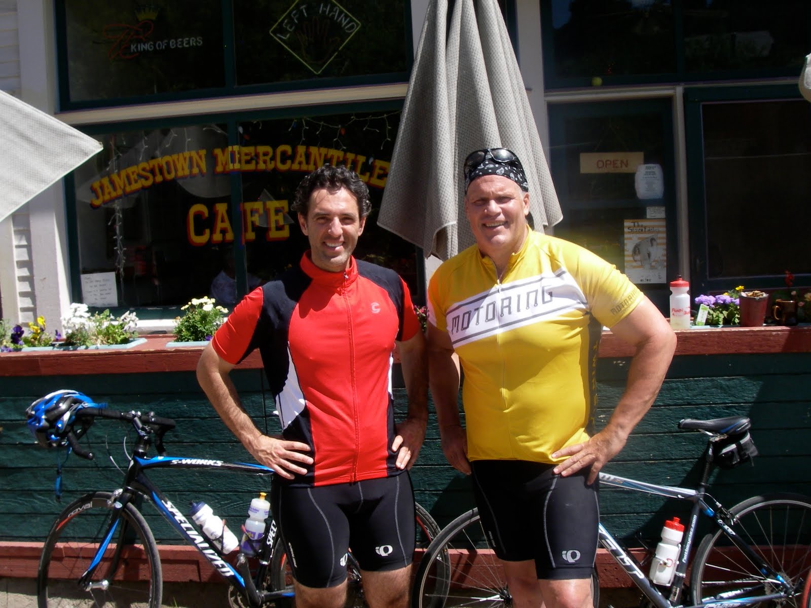
Pictured above Andrés Salazar and myself at the beginning of a big ride last Saturday, July the 3rd, 2010. Andrés was nice enough to join me for a spin up to the Jamestown Mercantile. From there, in preparation for this year's Triple Bypass, I rode Super Jamestown, a steeper climb further up above Jamestown. Then I descended to the Left Hand Canyon turnoff and rode up Left Hand Canyon, a Boulder classic. From there I returned down Left Hand and up over Lee Hill back into Boulder. It was about 7,000 feet of climbing in 61 miles. Below are a map of the route and an elevation chart from my Garmin.

It was a great ride and I felt good afterwards. I guess France was good training for the Triple Bypass. I'll find out how true that is tomorrow. On the 4th of July I road up to Jamestown again with my friends Brenda Maller and Julie Gillaspie for the Jamestown 4th of July parade, replete with the traditional kazoo marching band, a vintage fire wagon, and all the local kids on their bikes. Brenda and Jules in Jamestown below.

Of course with Brenda leading we had to go up to Jamestown the hardway. We had the steep climb up over Olde Stage Road on the way up and we came back over Lee Hill. On the upside, up on Lee Hill Brenda spotted a Western Tanager. I love seeing these colorful birds and had not seen one yet this year.

I think a lot about how cycling in France compares to riding in Colorado. I am fortunate to live in Boulder. The riding around here is incredibly varied and great. We can ride flat on the plains or we can pretty much pick any climbing gradient we want by choosing among the various climbs west of town that take us up into the mountains. But I have also been fortunate enough to vary my riding with some incredible bicycling trips throughout the Rockies from Montana to New Mexico; in the California Sierras; in the mountains of the American South East; and of course in France.

So how does France compare to Colorado for cycling. It's different and in that difference lies the pleasure. The first time I went to France to ride was a trip two years ago when I went to the Pyrenees. A friend of mine asked me if I was sure I could make it up the Col du Tourmalet. My friend was a good cyclist and his question gave me pause. How hard could it be?
Three days before I left for France I did one of the hardest short climbs we have here in Boulder: the front side of the Lee Hill Road plus the mile and a half up the Deer Trail Road at the top of Lee Hill. The first mile of the Lee Hill Road after the Olde Stage Road turnoff averages about 11 %. There is a bit of a break and a downhill after a false summit then another three quarters of a mile of so at about 11% to the true summit to which I added another mile and a half of unrelenting steepness up Deer Trail. I road the route nonstop and thought to myself that if I can do this how much harder can the Tourmalet be? The answer was not harder, just different.

I had incredibly good riding in the Pyrenees and I thought I road well. As a Clydesdale I am not a fast climber, but the altitude difference between Colorado and the Pyrenees is huge, and while I would be gasping for air on a big Colorado climb like Independence Pass, on the Col du Tourmalet I found myself spinning easily to the top chatting with the people around me. I had pretty much the same experience riding in the Alps. The fact I ride at such a high altitude here in Colorado is a huge advantage in France (the way Hank rode in the Alps was super-impressive given that his training mostly involved spinning in front of his TV in White Bear Lake, Minnesota - elevation 950 feet). The the top of Alpe d'Huez is only 700 feet higher than my bedroom in Boulder. Compare the profile of Independence Pass.


The top of the Col du Tourmalet is at 6,964 feet. The top of Independence Pass is at 12,100 feet. The highest point that Hank and I rode to in the Alps was the summit of the Col du Galibier at 8,678 feet.

The other big difference is that the French descents were typically much more technical. You could never just let your bike go as there was always a switch back turn coming up. In Colorado I can hit 50 miles an hour on a straight away descent. That didn't happen in France. Hank told me today he wore out his rear brake pads. I put on new brake pads before I left for France. I had an inkling of what was coming.

Speaking of what is coming, as I mentioned, tomorrow is the Triple Bypass ride - three passes, 120 miles of riding and over 10,000 feet of climbing. My friend Tony Klaich has come in from Chicago to ride it with me. I'll blog about it on Sunday.